Computer vision for physical infrastructure
We build systems that see, understand, and automate access control for gates, parking entrances, and secured entry points—reliably, at scale.
We build systems that see, understand, and automate access control for gates, parking entrances, and secured entry points—reliably, at scale.
GateGuardX is an automated gate access platform that retrofits existing entrances with license plate recognition (LPR/ANPR)—so authorized vehicles enter hands-free, without remotes, keypads, tickets, or on-site guards.
It combines a hardware kit + cloud software to automate access rules, keep a photo-verified audit trail of every crossing, and manage one or many sites from a centralized dashboard.
Where it fits
• Commercial & Industrial
• Residential Communities (HOAs)
• Parking & Mixed-Use (ticketless, pay-by-plate)
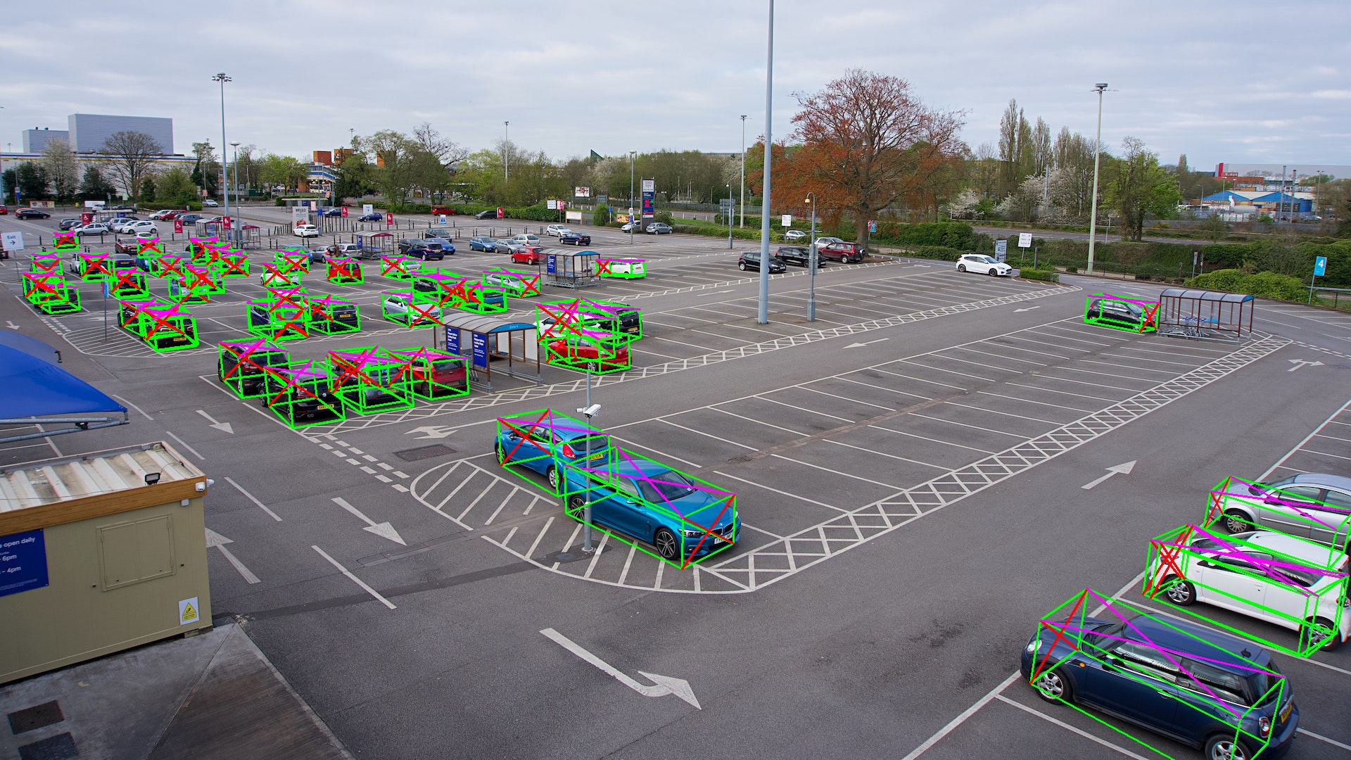
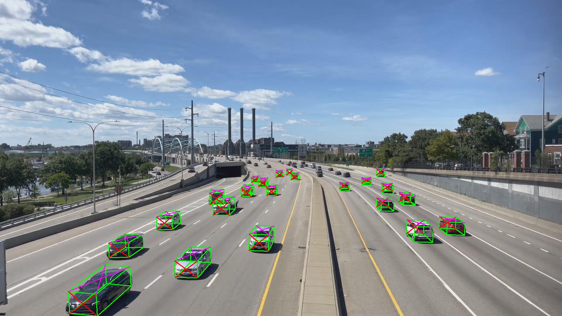
Real-time parking availability and utilization using outdoor cameras + an on-site edge device.
Get occupancy per spot, dwell time, and utilization trends—delivered to your dashboard or exported via API.
Gates were designed for people. Autonomous vehicles change that.
When there's no driver, there's no one to stop, explain, or talk to a guard. The gate must talk to the vehicle.
We're building the systems today that will enable that tomorrow—learning from real deployments what matters in the field: edge cases, reliability requirements, privacy constraints, and operational workflows.
Today, we solve hands-free access for human-driven vehicles. The same building blocks—identity, verification, audit trail, edge reliability—are what autonomy will require.


Real deployments teach us what matters: edge cases, reliability, privacy constraints, and operational workflows.
That’s how we turn vision into infrastructure-grade products.
Machine Can See builds computer-vision systems for real-world infrastructure.
We design infrastructure-grade, edge-first systems that run reliably outdoors—where automation, safety, and accountability matter.
• Reliability — built for continuous operation, not demos
• Privacy — edge processing with controlled data flows
• Accountability — photo-verified audit trails and traceability
Programs & partners